The devastating drought in California before and after images taken from Space


NASA recently published above satellite images from California, one was taken on July 2, 2011, just as the latest dry period began (Before), and the other was acquired on June 25, 2014 (After). The state is becoming increasingly less green, because of the persistent drought conditions. Also notice how the land based water drys up.
Now in its third year, the drought in California grows worse with each month. 2013 was the driest calendar year in 119 years of records, and 2014 has not brought much relief, even as scientists and residents wait hopefully for El Niño moisture. From stream gauges and reservoir levels to ground-based photos and satellite images, the landscape seems to grow browner and drier with each month.
In a weekly report issued on July 17 by the U.S. Drought Monitor, the entire state of California was classified as being in severe drought. The situation was declared extreme for 79 percent of the state’s land area and exceptional in 36 percent.
The pair of images above from the Moderate Resolution Imaging Spectroradiometer (MODIS) on NASA’s Aqua satellite captures a wide view of the situation.
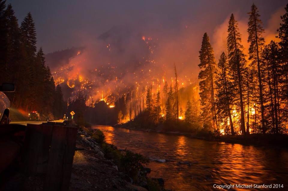
Meanwhile epic fire rages in central Washington..
Related
- The California drought and climate disruption
- ClimateDesk explains how drought make areas more prone to wildfire.
Teaser image obtained from Wikipedia.
About the Author: CLIMATE STATE
POPULAR
COMMENTS
- The risk with the path to a hothouse Earth | Climate State on Climate Tipping Points Existential Threat to Our Life Support Systems
- Robert Schreib on Electricity generation prices may increase by as much as 50% if only based on coal and gas
- Robert Schreib on China made a historic commitment to reduce its emissions of greenhouse gases
- Lee Nikki on COP30: Climate Summit 2025 – Intro Climate Action Event
- Hollie Bailey on Leaders doubled down on fossil fuels after promising to reduce climate pollution