Greenland ice sheet collapse, 400,000 years ago
New evidence suggest that the longest interglacial (the time in between ice ages) – a warming period, called Marine Isotope Stage 11, more than 400,000 years ago, created nearly complete deglaciation of southern Greenland, thus contributed 4-6 meters to global sea level rise at that period.
Overall sea level rose about 6-13 meters above present levels. The estimated attribution from Greenland has been scarce so far, the new study helps to close a gap. The new study also hints to our situation today, offers clues what we should expect.

Reporting Climate Science, has more: The study is one of the first to zero in on how the vast Greenland ice sheet responded to warmer temperatures during that period, which were caused by changes in the Earth’s orbit around the sun.“The climate 400,000 years ago was not that much different than what we see today, or at least what is predicted for the end of the century,” said Anders Carlson, an associate professor at Oregon State University and co-author on the study. “The forcing was different, but what is important is that the region crossed the threshold allowing the southern portion of the ice sheet to all but disappear.
“This may give us a better sense of what may happen in the future as temperatures continue rising,” Carlson added.
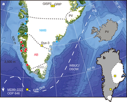
The researchers examined sediment cores collected off the coast of Greenland from what is called the Eirik Drift. During several years of research, they sampled the chemistry of the glacial stream sediment on the island and discovered that different parts of Greenland have unique chemical features. During the presence of ice sheets, the sediments are scraped off and carried into the water where they are deposited in the Eirik Drift.
“Each terrain has a distinct fingerprint,” Carlson noted. “They also have different tectonic histories and so changes between the terrains allow us to predict how old the sediments are, as well as where they came from. The sediments are only deposited when there is significant ice to erode the terrain. The absence of terrestrial deposits in the sediment suggests the absence of ice.
“Not only can we estimate how much ice there was,” he added, “but the isotopic signature can tell us where ice was present, or from where it was missing.”
This first “ice sheet tracer” utilizes strontium, lead and neodymium isotopes to track the terrestrial chemistry.
Carlson said the ice sheet loss likely went beyond the southern edges of Greenland, though not all the way to the center, which has not been ice-free for at least one million years.

South Greenland ice-sheet collapse during Marine Isotope Stage 11
Nature 510, 525–528 (26 June 2014) doi:10.1038/nature13456
Varying levels of boreal summer insolation and associated Earth system feedbacks led to differing climate and ice-sheet states during late-Quaternary interglaciations. In particular, Marine Isotope Stage (MIS) 11 was an exceptionally long interglaciation and potentially had a global mean sea level 6 to 13 metres above the present level around 410,000 to 400,000 years ago, implying substantial mass loss from the Greenland ice sheet (GIS).
here are, however, no model simulations and only limited proxy data to constrain the magnitude of the GIS response to climate change during this ‘super interglacial’, thus confounding efforts to assess climate/ice-sheet threshold behaviour and associated sea-level rise. Here we show that the south GIS was drastically smaller during MIS 11 than it is now, with only a small residual ice dome over southernmost Greenland.
We use the strontium–neodymium–lead isotopic composition of proglacial sediment discharged from south Greenland to constrain the provenance of terrigenous silt deposited on the Eirik Drift, a sedimentary deposit off the south Greenland margin. We identify a major reduction in sediment input derived from south Greenland’s Precambrian bedrock terranes, probably reflecting the cessation of subglacial erosion and sediment transport as a result of near-complete deglaciation of south Greenland.
Comparison with ice-sheet configurations from numerical models suggests that the GIS lost about 4.5 to 6 metres of sea-level-equivalent volume during MIS 11. This is evidence for late-Quaternary GIS collapse after it crossed a climate/ice-sheet stability threshold that may have been no more than several degrees above pre-industrial temperatures.
Related
- Ancient glacial melting shows that small amount of subsurface warming can trigger rapid collapse of ice shelves
- Greenland’s fastest glacier sets new speed record
Another analogous period was MIS5.
High rates of sea-level rise during the last interglacial period
Marine Isotope Stage (MIS) 5e (around 123,000 years ago), was the last interglacial period before the present (Holocene), and compared global mean surface temperatures were at least 2 °C warmer. Mean sea level was 4–6 m higher than at present, following reductions of the Greenland ice sheet. Fossil reef proxies indicate sea level fluctuations of up to 10 m around the mean. Based on the data obtained from stable oxygen isotopes of planktonic foraminifera and age constraints from corals, estimates suggest average rates of sea-level rise of 1.6 m per century. The findings are important to understand current climate change, because global mean temperatures during MIS-5e were similar to the projected climate change today.
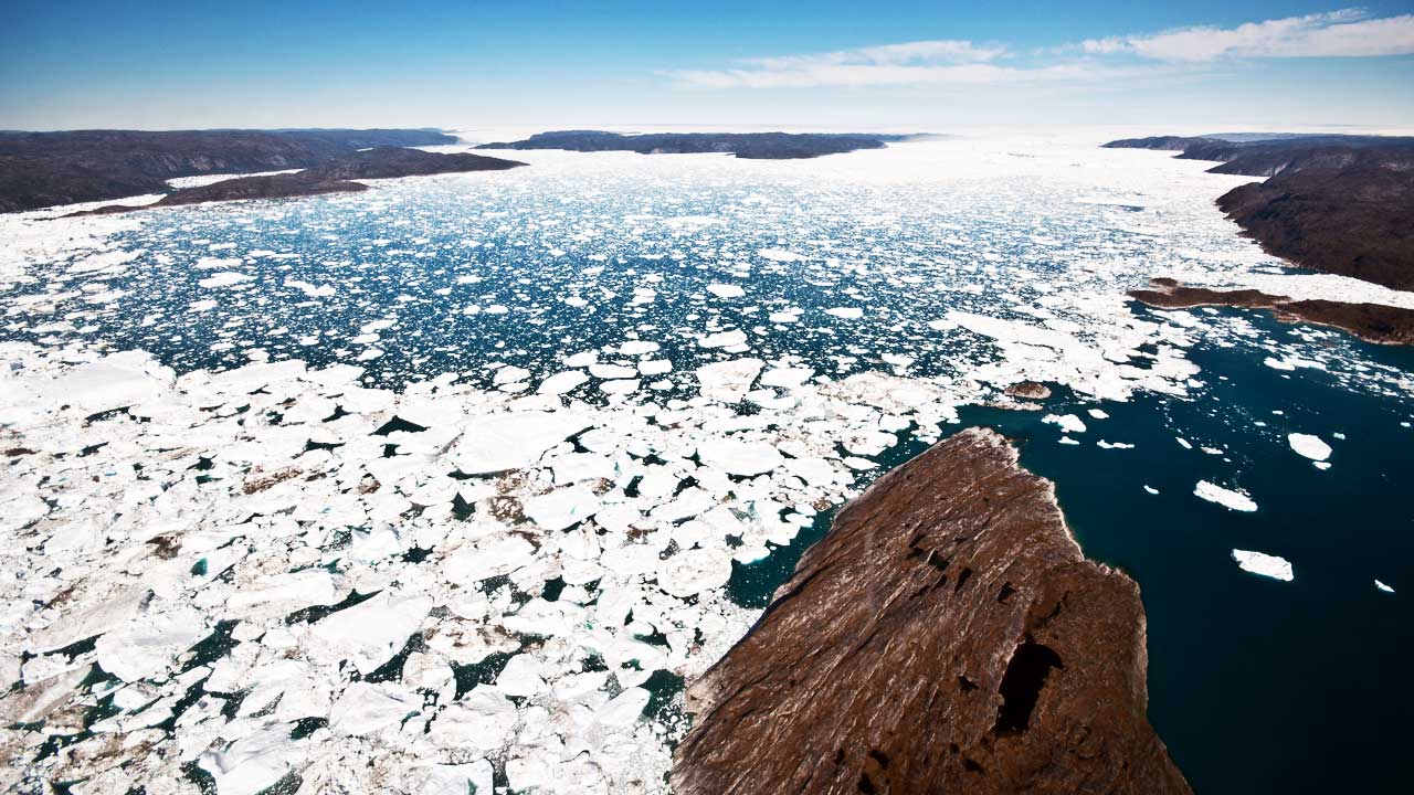
The teaser image shows the Sermilik fjord (Sermilik Station), a place where hundreds of icebergs calve from Greenland’s vast ice sheets.
- Study shows Antarctica’s impact on sea – A massive melt from the Antarctic ice sheet 14,600 years helped increase global sea levels by 16 metres
- Under the Ice: A closer look at recent Antarctica and Greenland Ice Melt
About the Author: CLIMATE STATE
POPULAR
COMMENTS
- The risk with the path to a hothouse Earth | Climate State on Climate Tipping Points Existential Threat to Our Life Support Systems
- Robert Schreib on Electricity generation prices may increase by as much as 50% if only based on coal and gas
- Robert Schreib on China made a historic commitment to reduce its emissions of greenhouse gases
- Lee Nikki on COP30: Climate Summit 2025 – Intro Climate Action Event
- Hollie Bailey on Leaders doubled down on fossil fuels after promising to reduce climate pollution