Canada’s shocking oilsands operation (Aerial footage)

DeSmog Canada published a stunning series of aerial photos from Canada Alberta, showing how tar sands are developed.
Alex MacLean is one of America’s most famed and iconic aerial photographers. His perspective on human structures, from bodies sunbathing at the beach to complex, overlapping highway systems, always seems to hint at a larger symbolic meaning hidden in the mundane. By photographing from above, MacLean shows the sequences and patterns of human activity, including the scope of our impact on natural systems. His work reminds us of the law of proximity: the things closest to us are often the hardest to see.
Recently MacLean traveled to the Alberta oilsands in western Canada. There, working with journalist Dan Grossman, MacLean used his unique eye to capture some new and astounding images of one of the world’s largest industrial projects. Their work, funded by the Pulitzer Center on Crisis Reporting, will form part of a larger, forthcoming report for GlobalPost.
DeSmog Canada caught up with MacLean to ask him about his experience photographing one of Canada’s most politicized resources and the source of the proposed Keystone XL and Northern Gateway pipelines.
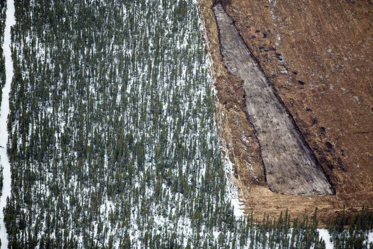
Forest removal for exploratory well pad. Shell Jackpine mining site, North of Fort McMurray, Canada.
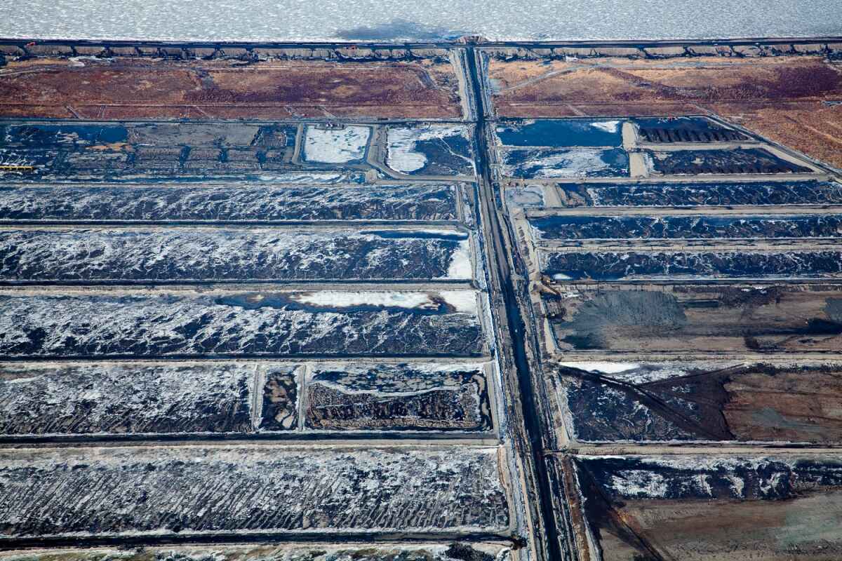
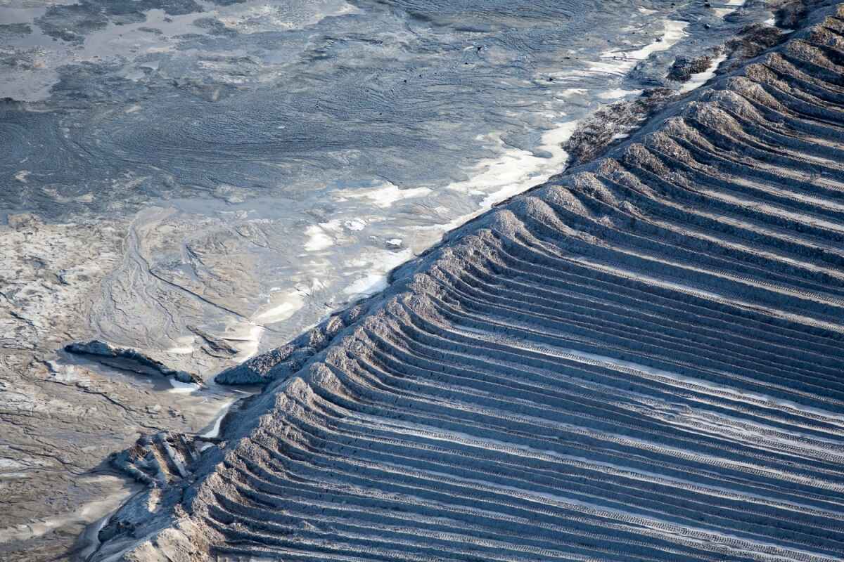
Beds leading up to tailing pond.
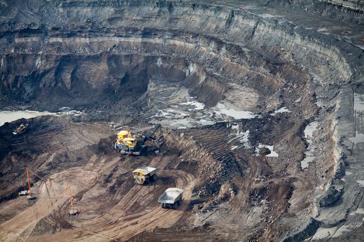
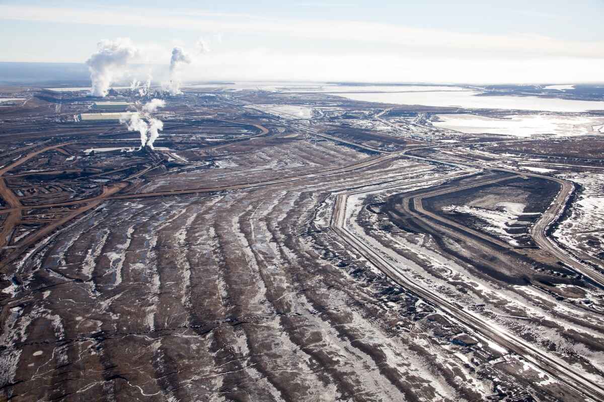
Mining operations at the North Steepbank Extension. Suncor mine, Alberta, Canada.
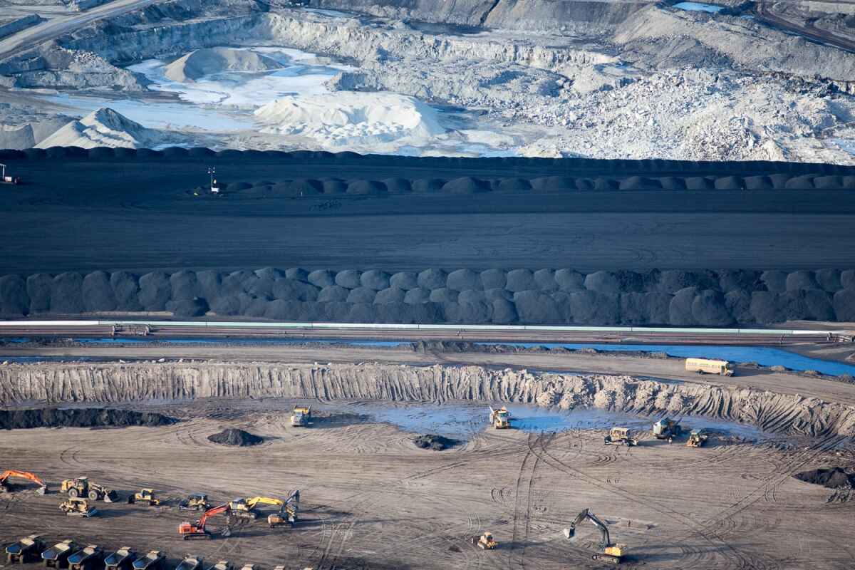
Suncor Oil Sands Project. Piles of uncovered petrolum coke, a byproduct of upgrading tar sands oil to synthetic crude. “Petcoke” is between 30-80 per cent more carbon intense than coal per unit of weight.
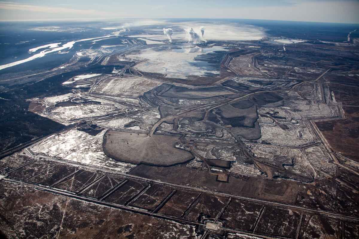
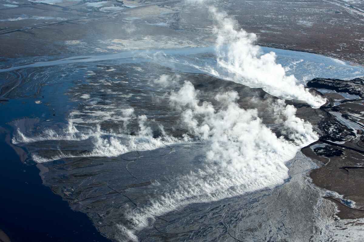
Syncrude Mildred Lake mining site. View south to upgrading facility with rising plumes of steam and smoke. Alberta, Canada.
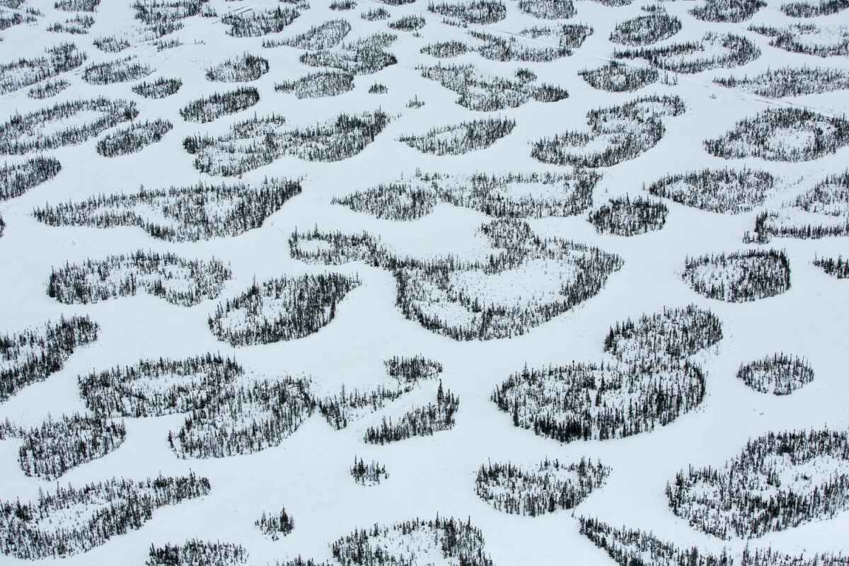
Patches of boreal forest intertwined with snow-covered muskeg, near McLelland Lake, Alberta, Canada.
Steam and smoke rise from the Syncrude Mildred Lake mining facility.
Earthen wall to tailing pond. Suncor mining site, Alberta, Canada.
Hot waste filling tailing pond. Suncor mining site, Alberta, Canada.
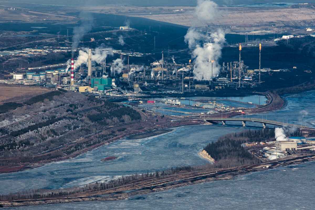
Smoke, steam, and gas flares rise from the Suncor upgrading facility. Reclamation efforts seen to the right, on what was once a tailing pond. Suncor has reclaimed only 7 per cent of their total land disturbance.
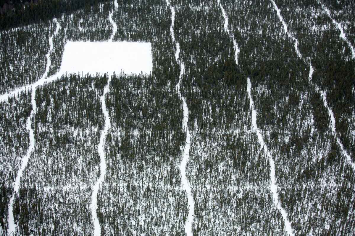
Seismic lines and well pad for exploratory drilling through the boreal forest at the Suncor Firebag Oil Sands Project. Alberta, Canada.
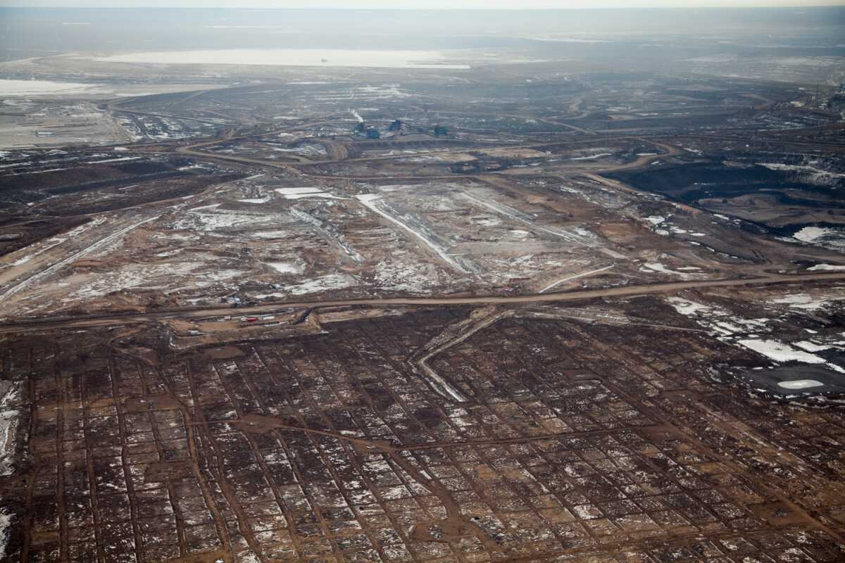
Checkerboard clearing of the overburden at Syncrude Aurora North mine site. Alberta, Canada.
Clearing, dewatering, and seismic grid over the once boreal forest. Syncrude mining site, Alberta, Canada.
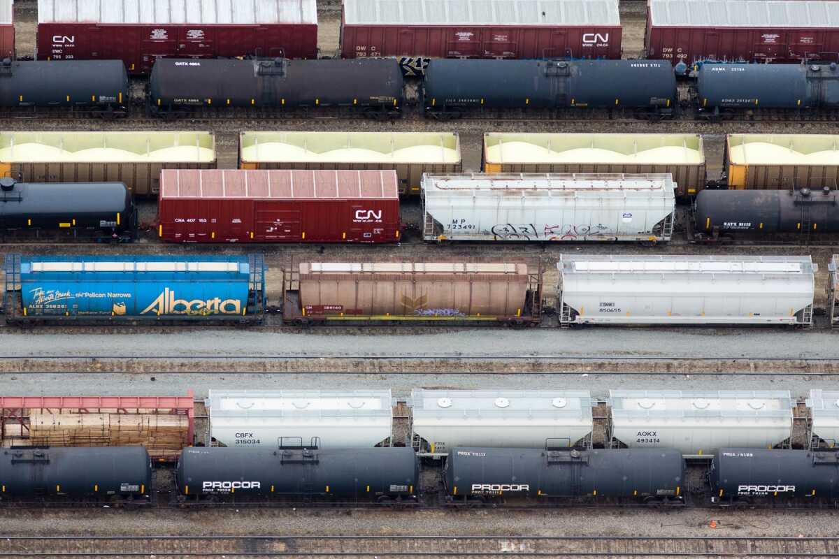
Open box cars carrying sulfur byproduct. Edmonton, Canada.

Surface oil on tailing pond. Suncor mine near Fort McMurray.
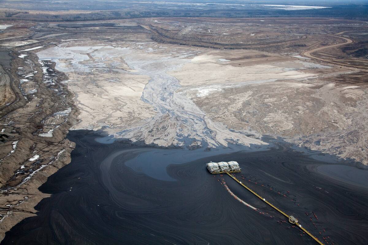
Overview of tailing pond at Suncor mining site.
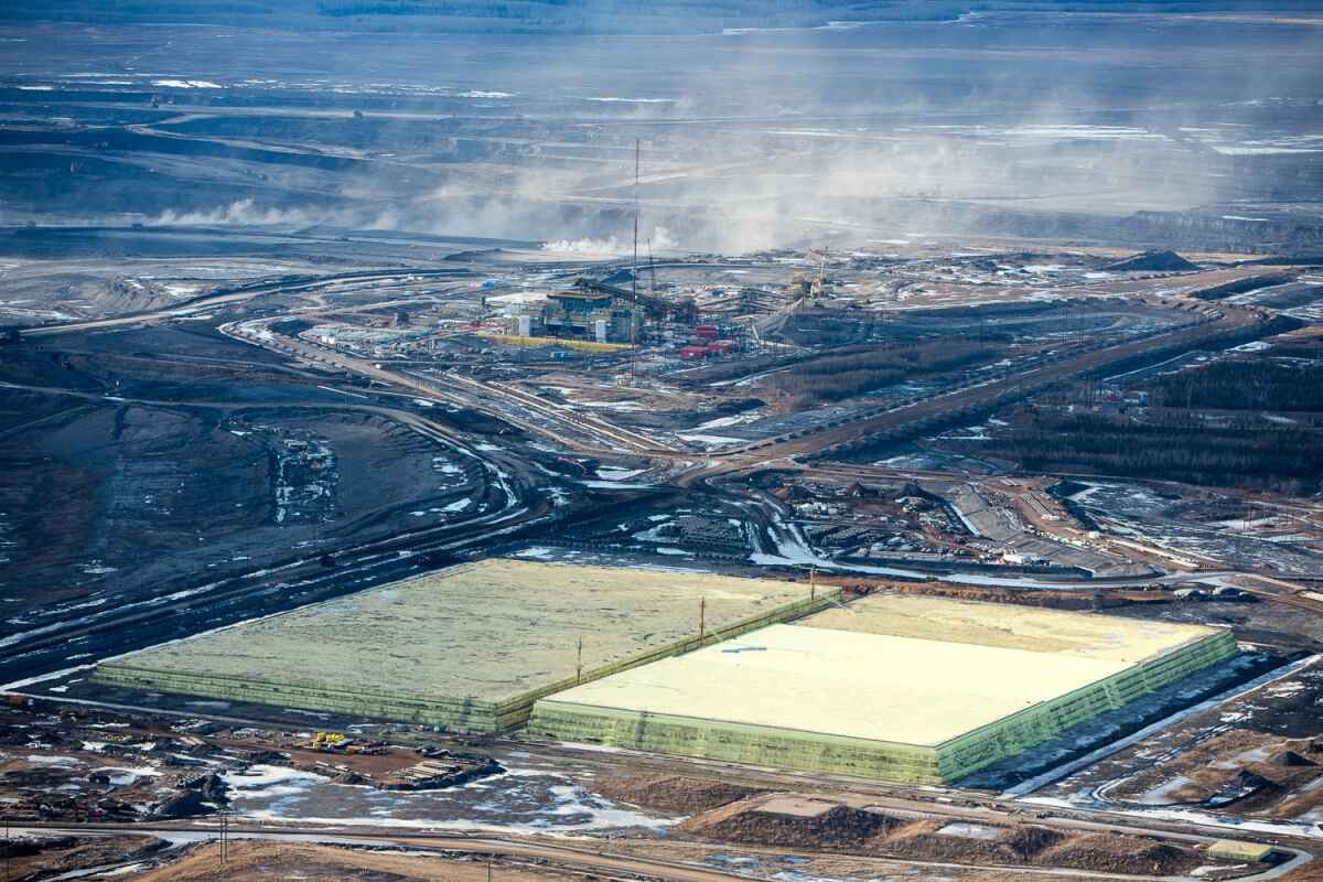
Growing pyramids of sulfur, a byproduct of upgrading bitumen. Mildred Lake, Alberta, Canada.
Interview
DeSmog Canada: What was it like photographing the oilsands? Was it different from photographing other large-scale human spaces like highways or beaches?
Alex MacLean: The oilsands covered a vast area of which I was only able to photograph part of. It was not only different from highways, beaches, etc., in that those are linear formations, but the scale of the oilsands area and the devastation to the landscape was overwhelming. I felt a relation between highways and the mines in that open pit mines and seismic exploration lines fragment the boreal forest just as highways do through urban areas.
DeSmog Canada: What led to your interest in the Alberta oilsands?
Alex MacLean: I have been photographing around the issues of climate change since early on, and actually put out a book looking at land use patterns as they relate to energy and consumption in 2008 called “OVER: The American Landscape at the Tipping Point.” I was drawn to photographing the pipeline because I feel as though there is little public awareness that, if built, the Keystone XL will make avoiding catastrophic climate change much harder. The pipeline is an important link in a fossil-fuel production machine, stocked with bitumen deposits at one end and refineries at the other. The public is unaware that this oil production machine is poorly regulated, though it will cause serious environmental and health effects on local, regional and planetary scales.
DeSmog Canada: What is it like taking a bird’s eye view of humanity? Do you sometimes have great insights looking at civilization from such a removed, abstracted position?
Alex MacLean: One of the interesting things about aerial photography is how so much of what you see about humanity is devoid of people. What I see is tracks and markings that are telling about our culture and values. When you see the destruction of landscapes, in this case of the boreal forest, with the obvious contamination of the environment via water and air pollution, you can’t help but feel that there is very short-sighted exploitation of natural resources that will have long-lasting environmental impacts.
DeSmog Canada: You’ve been photographing ‘human’ spaces for a long time. Have you noticed a change over the last few decades in your perspective as society has grown more aware of the ecological crisis and the scale of our impact?
Alex MacLean: You can’t help but notice the growth that has taken place in the last thirty years, and the build-out of what was once natural spaces. I would say in the last 15 years, at an escalating rate, you begin to see more sustainable sources of energy through wind and solar farms, and reconfiguring of urban spaces to make them more walkable.
Photo credit: All photos copyright Alex MacLean. Reposted here with permission.
Related
- New Map Shows Dramatic Time Lapse of Tar Sands Deforestation
- Second Government Agency Confirms Canada’s Decline in Renewable Energy
About the Author: EARTH CLIMATE
Support
Paypal DONATE – Your donation goes towards supporting this website, including covering hosting, posting new content, creation of videos, software licenses, or paying invited guest authors. Another way to support Earth Climate is by becoming a Patreon.
[…] But you know this and much more. We all know this and much more! How long are we going to hide from this? It would take a hundred Manhattan projects to do something real, true, but wouldn’t it be […]